Barker Bay Outposts - Located on Lower Manitou
Links Tips Link Photos Link Location Link Contact Link Rates Link Winter Link Hunting Link Lodging Link Fishing Link Home Link


Lower Manitou Map

Lower manitou lake map


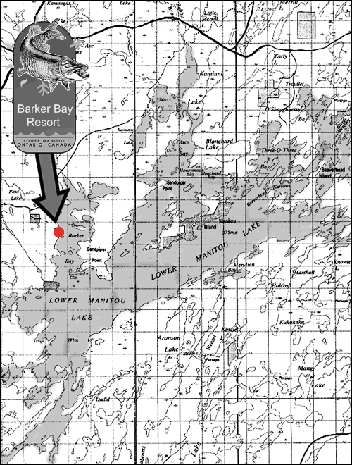
GPS Coordinates to remember
North 49 degrees 16.132...West 93 degrees 02.913 - Our Dock at Barker Bay
North 49 degrees 05.673...West 93 degrees 16.297 - Rock Hazard in Esox Lake
North 49 degrees 07.352...West 93 degrees 15.454 - Rocky Channel from Esox Lake into the Manitou Stretch


I Fishing I Lodging I Rates I Winter I Hunting I Contact Us I Location I Photos I Home I

Email : info@barkerbay.com

All Images ©2010 Barker Bay Outposts